
The Pope is coming to Philadelphia this weekend. Security measures include banning cars, closing bridges, transit and schools and building a fence around the event perimeter. To keep track of all this data scientist Lauren Ancona has created the Philly Pope Map showing all available public data.
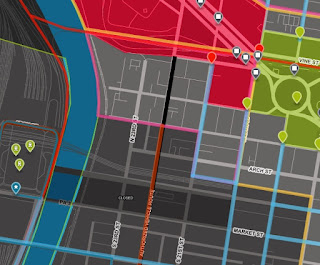
 There is also a timeline for the various closures. Here's a zoomed in version.
 There's a bit of an assumption that you know what some of these colored areas are. If you're in the area you probably do but for the rest of us, a legend would be helpful. This map from the Philadelphia Inquirer helps explain the different zones, but doesn't have the same interactive pizzazz.
 If you come in from out of town and you don't want to pay for an over-inflated hotel room, you can pay for an over-inflated campsite at "Francis Fields" in beautiful Fairmount Park. Of course, you'll have to walk the two plus miles each way.
UPDATE: Actually no, you can't - they just cancelled it due to lack of demand for over-inflated camping.
 Personally, I think I will wait at least a few more weeks before my next visit.
UPDATE: Actually no, you can't - they just cancelled it due to lack of demand for over-inflated camping.


No comments:
Post a Comment