
Pergeo is a Spanish mapping company and friend of the blog. They produce nice pictorial maps and guides of various cities and regions, mostly in southern Spain. Here is Seville.
 A higher resolution image of the city center shows an impressive level of detail.
 These details do not detract from the map's useability. All streets are shown on the city maps and the ones closed to auto traffic are apparent.
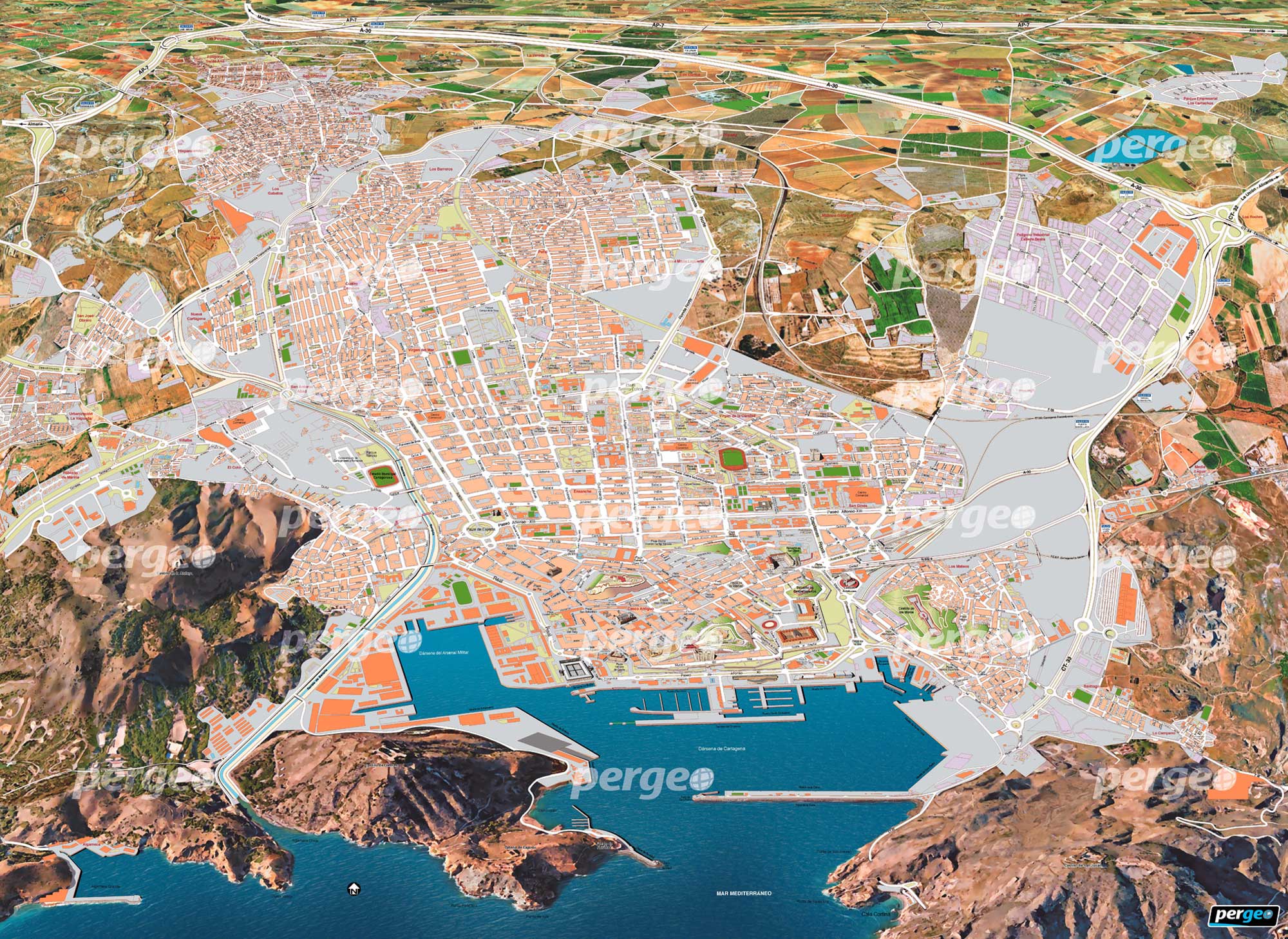
The outer areas of the cities also have nice details. Here we see the farms, hills and highways (usefully including exit signs) on the edge of Cartagena.
 Printed copies of these maps are sold locally. Some of the tourist
areas and sites such as the Mosque of Cordoba have their own detailed
maps.
Printed copies of these maps are sold locally. Some of the tourist
areas and sites such as the Mosque of Cordoba have their own detailed
maps.
 The country map is a bit more whimsical, showing mostly monuments, cathedrals and oversized people and animals. Each province has a representative landmark. The Eiffel Tower and Big Ben at the far edge of the map are nice touches.
 They also produce transit maps, historical maps, maps of provinces and resort areas as well as various other illustrations. For more see their web page.
The outer areas of the cities also have nice details. Here we see the farms, hills and highways (usefully including exit signs) on the edge of Cartagena.


No comments:
Post a Comment